

The slow road north from San Francisco
After the Golden Gate Bridge, the coast road through West Marin trades the city for redwood forest, a hidden surf town, grazing elk, and oysters pulled straight from Tomales Bay.
Every time I drive north on the Golden Gate Bridge, I’m taken by how quickly San Francisco’s urban edge melts away.
When leaving the city, the bridge’s orange-red span is famous for cutting against SF’s dove-grey sky. On the other side, the rugged Marin Headlands separate the Pacific Ocean from the rest of Marin County. After crossing the 1.7-mile-long bridge, the road slips through the coastal range via the Robin Williams Tunnel, known locally as the Rainbow Tunnel.
This always makes me look up and smile. The sky is blue, the headlands have almost always held back the Bay fog, and in just 10 minutes, San Francisco feels miles away.
The drive north from San Francisco to Marshall, California, takes about three hours, with a few stops to breathe it all in. It leaves behind the California of social media and finds something wilder and slower: a place that feels like it belongs to an earlier time.
Into the redwoods
Out of the tunnel, Shoreline Highway climbs past wood-paneled homes tucked among California live oaks and eucalyptus. The road bears right onto Panoramic Highway and keeps climbing along the spine of Mount Tamalpais. Out the driver’s window, native forest falls toward the Pacific, 1,500 feet below. The name is not an exaggeration.
The 1912 Mountain Home Inn marks the last building before the wilderness takes over — an alpine-style lodge built by Swiss-Germans as a mountain escape for San Franciscans, and still serving breakfast on a terrace with the whole bay laid out below. Just past it, a turnoff drops down to Muir Woods National Monument: 554 acres of protected coast redwoods, some 800 years old. It’s worth the detour, but book a parking reservation ahead of time. The lot fills early, and walk-ins aren’t guaranteed. I always roll the window down on the way in; the earthy smell of redwoods and Douglas firs arrives before the trees do.
Back on Panoramic, the road begins its descent, and the forest closes in on both sides. By the time you pass Pantoll Campground, the lane darkens, twisting enough to feel more like a trail than a highway, until one final tight turn opens the woodland onto a long view: the town of Stinson Beach along its wave-lapped coast, and the flat expanse of Bolinas Lagoon below, wedged between the mountainside and the sea.
Stinson Beach and the lagoon
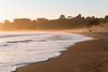
At sea level, the highway becomes a block-long main street with no sidewalks and no streetlights. Stinson Beach has about 500 year-round residents and around 800 part-time ones; I’ve counted myself among the latter. Low-key and unhurried, spring can bring clear days, but by July, the sky often turns grey and misty. Fortunately, the Parkside Cafe keeps its outdoor tables warm with heat lamps year-round, so you can swing by for a summer sunset or enjoy the more atmospheric, foggy days.
Stinson Beach runs three miles from town to a narrow tidal channel that separates Stinson from Bolinas. That channel feeds the Bolinas Lagoon, visible on the left as you continue north on Highway 1. It’s a protected wetland that shifts with the tides, an Audubon Society Important Bird Area, and part of the UNESCO Golden Gate Biosphere Reserve.
More than 200 bird species depend on the lagoon, including enormous pelicans that glide almost effortlessly in diagonal formations. I’ve spotted snowy egrets and great blue herons working the shallows, long-billed shorebirds digging for bugs along the banks, and sandpipers that suddenly spiral upward in groups of a thousand or more before suddenly settling back down. I’m not a birdwatcher, but this stretch of road will make one out of almost anyone. Pull over for it.
Bolinas, the town that hides on purpose
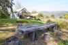
At the far end of the lagoon, a road turns left toward Bolinas, though you likely won’t see a sign for it—they get removed by locals almost as fast as the county puts them up. It’s a habit that started in the 1970s, when a wave of artists, hippies, and counterculture transplants left San Francisco for Bolinas and decided they’d rather tourists couldn’t find them. Eventually, the county gave up on replacing them. You either know the turn, or you miss it.
Once you’re in, Bolinas runs on two histories at once. Transient loggers in Bolinas felled the giant redwoods here that became the plank sidewalks and buildings of San Francisco in the mid-1800s, and a century later, the artists and Beatniks who influenced the town’s more Bohemian direction. Both still show on Wharf Road, where Smiley’s Saloon (built in 1851 with credible claim as the oldest continuously operating bar on the West Coast) has been serving through all of it. Across the street, the Bolinas General Store occupies what used to be a stagecoach barn, and the Coast Café Bolinas kiosk next door handles the coffee. Whatever wariness the town is known for is mostly folklore now.
At the end of Wharf Road, the channel opens back to the lagoon. On an incoming tide, harbor seals ride the current in to rest on the mud flats beyond; on the ebb, they ride it back out. A fold in the shoreline here gives Bolinas its own pocket of sun, so it’s often bright here even when Stinson is socked in fog — worth knowing before you decide where to spend the afternoon.
The fault line, the bay, and the seals
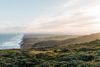
Soon, Highway 1 runs along a narrow meadow, tracing the San Andreas fault line that separates the North American and Pacific tectonic plates. North of the town of Olema, the land slips below sea level and fills with water, becoming Tomales Bay: 15 miles long, a mile wide, and calm compared to the ocean.
Highway 1 runs north along the bay, but the peninsula it borders is worth a detour. From Point Reyes Station, Sir Francis Drake Boulevard heads west into Point Reyes National Seashore, passing through Inverness, a shoreline village built in the late 1800s. Soon, it narrows under the Cypress Tree Tunnel, where two rows of Monterey cypress have grown together overhead, canopies fused by decades of salty wind.
Past the trees, the land opens into bare, rolling grassland that runs to the Chimney Rock headland at the peninsula’s tip. Below the bluffs, sandstone cliffs drop as much as 300 feet to the beach at Drakes Bay, where several hundred elephant seals haul out — nursing pups in midwinter, molting adults by summer. From the Chimney Rock parking lot, a mostly level .3-mile stroll leads to the Elephant Seal Overlook, where you can watch the colony from the cliff edge; the beach itself stays closed to protect them, and on winter weekends, park docents are usually stationed there to help you spot what’s happening below. Binoculars are helpful.
Point Reyes Station and the dairy country
The town of Point Reyes Station began as a railroad outpost in 1875, and the main street reflects that with Old West storefronts and the original train depot that now serves as the post office. Close to the post office is where you’ll find Bovine Bakery, deserving of the line that forms most mornings for coffee and cookies.
A few doors down, the Palace Market has been feeding West Marin since 1898, when it sold dynamite, denim, and dry goods to ranchers and rail workers. Don’t skip the soft serve, made with creamy Jersey-cow milk from a dairy up the road that’s become a local staple. The farms and organic dairies of West Marin supply some of the best kitchens in Northern California, and the quality of what’s stocked here, nonchalantly, on a small-town grocery shelf, is a fair preview of why.
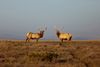
Back on Highway 1, Tomales Bay sits on the left and the hills rise on the right. A couple of outfitters along the way run kayak tours onto the water, within sight of Tomales Point at the northern tip of Point Reyes, where a herd of tule elk grazes the open ridge. Endemic to California and the smallest elk in North America, they were hunted nearly to extinction by the late 1800s and reintroduced to the national seashore in 1978, which now counts roughly 700 across its three herds.
The oysters at Marshall
Marshall is less a town than a point on the map. The primary reason to stop is the Hog Island Oyster Co, a working dock where oysters pulled from Tomales Bay sit in tanks of constantly refreshing water until they’re sold.
There’s no indoor restaurant — just wooden tables, umbrellas, and the calm flat water with Point Reyes across the way. Order the oysters fresh on the half shell, or fire-grilled with a little butter, alongside local cheese and a glass of white from neighboring Sonoma County.
A few hours ago, you were in the middle of San Francisco. But as you sit at a wooden table, dining on oysters that were in the bay this morning, the city feels much further than a morning’s drive away.
Places to stay
Tomales

Go further with the Expedia app
